Stockton Heath, Lymm and Culcheth are vibrant, cultural and lively villages in Warrington. Alongside wonderful green spaces they offer lots of shops, restaurants, cafes and bars that will delight people of all ages.
Stockton Heath and Lymm both boast being near the Bridgewater Canal, and Stockton Heath is also a stone’s throw away from Walton Hall and Gardens.
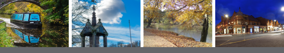
Village life - Stockton Heath, Lymm, Culcheth
Image
The history of Warrington's villages and parishes
History of Appleton, Stockton Heath, Stretton and Walton
Appleton
Appleton appeared in the Domesday survey as 'Epeltune' and means 'the tun where the apples grew.'
The Appleton Cross near Pepper Street, reminds us of a Warrington friar, in 1365, Richard de Apulton who was ordained as the sub-deacon at Colwich.
Bawming the Thorn
Appleton Thorn hosts the 'Bawming the Thorn' each June. The ceremony dates from the nineteenth century, when it was part of the village’s 'walking day'. It involved children walking through the village and holding sports and games at the school. This now takes place at the village hall. The ceremony stopped in the 1930s, but was later revived by the then headmaster, Mr Bob Jones in 1967. Bawming the Thorn occurs on the Saturday nearest to midsummer's day, and local schoolchildren dance around the tree.
Stockton Heath
This is mentioned in 1739 as 'Stoken' in Moll's map of Cheshire and derives from two Old English elements: 'stoc'/'stocc' and 'tun' (the name 'Stockton' is very old). The most likely meaning of its name, 'Stoc-tun', means 'a tun belonging to a cattle or dairy farm'.
Stretton
The name Stretton is derived from the fact that a Roman road passed through Stretton to Wilderspool and it means the tun on the 'stret' or the road. Like Appleton, Stretton also had a thorn tree and underneath it there were the village stocks. Stretton's church was built on the site of an old chapel of ease in 1827 and was restored in 1870.
Stretton Hall
Stretton Hall was the home to the Starkey family from Henry IIs reign until the 18th century. The building is of Elizabethan structure and was described in an auction at 1884 as "an excellent country residence for a gentleman however good his position".
Walton
There are three different meanings for the name of ‘Walton’, these being a ‘tun where Britons live’, a ‘tun by a wall’ and a ‘tun in a wood’.
Gilbert Greenall lived in Walton Hall from 1836 until his death in 1894. His son then lived there until his death in 1938, he was made the first Baron of Daresbury in 1927. After his death, the hall was sold to Warrington Corporation in 1941. The hall is now used as a venue for conferences, and the extensive grounds hosts gardens, a children's zoo, and children's play areas. Next to the hall is the municipal golf course with its impressive views.
One of Warrington's most important Georgian buildings, after the town hall, is Baronet Farm built in 1740. The farm has been virtually unaltered since the time it was built.
History of Orford, Bewsey and Whitecross
Bewsey
Part of the estate belonged to the monks of Titley Abbey, Essex. A monastic grange had been built known as 'Beausee' which meant beautiful site. Between 1264 and 1280, the hall was owned by William de Boteler, Lord of the Manor of Warrington.
In 1255 William de Boteler, under the authority of Henry III, granted Warrington its first market charter.
Bewsey Old Hall
By 1307 the Boteler family had made it their home. They lived here until 1586 when the hall was passed to the Earl of Leycester, Robert Dudley and then on to the Bold family. In 1597, the estates and the hall were passed to the Ireland family.
The hall had a royal visitor when James I stayed there for a night.
The present structure is no earlier than 1597, it was probably rebuilt by new owners which often happened to these houses. There is nothing left of the de Boteler’s original moated house. The grounds go down to part of the Sankey Navigation where there is an unusual sluice and a lock.
After World War One, Bewsey was chosen as an area for new housing development, making the town come even nearer to the hall. During the Second World War, there were many Americans stationed in the area and an American family even stayed in the hall for a while.
Orford
Orford was part of the Warrington Manor mentioned in the Domesday Book. The name Orford means 'upper ford'.
In the 19th century, there was a large enclosed area which may have been a park - which is now Greenwood Crescent. It can be dated as far back as the 15th century, when it’s thought that a park was created for hunting after 1066. Old parks usually suggest old halls and this may have been the first site of Orford Hall.
Orford Hall
The hall was a white-fronted house at the bottom of Orford Avenue and was one of the most important buildings in Warrington, yet there isn’t much documentary evidence about it. It was demolished in 1935.
William Beamont, a local historian, lived there for 23 years and he thought there was a originally a moated house, built on the site in the 13th century, by the Norris family – and a sketch by Robert Booth in 1830 shows a house called 'Norris House'. This house is dated as being 17th century.
Then, when Elizabeth or Anne Norris married Thomas Tildesley around 1616, he built a large mansion which in 1633 was known as the ‘Hall of Tildesley’.
The area of land belonging to the hall, now known as Orford Park and Longford Fields, was often flooded and in winter used for ice-skating. Because of the flooding, John Blackburne raised the road on the causeway at Longford. As recent as 1920, there was a memorial bowling green on part of the waterlogged site.
In 1638, Thomas Blackburne bought the former Norris Hall and estate and his son, Johnathon, made major alterations to the hall. Joseph Litton owned the house after Blackburne but it’s thought that he moved due to the arrival of the railway.
John Blackburne bought the manor of Warrington in 1764 and it’s probably he who planted the avenue of limes, which now form Orford Lane.
After the Blackburnes, the hall was let to the Honourable Lucy Hornby, whose grandson Edmund was the first MP for Warrington borough. After her death, her two daughters let the hall to the Misses Rigg and Fishwick, and it was then used as a young ladies school. It then became the home of William Litton, his two sisters, Mary and Jane, and his brother, Joseph, until 1866.
The Beamonts then lived here. William Beamont was the town's first mayor and following his death in 1889 his widow, Letitia, remained at the hall. When the Beamonts left the property it was left to go to ruin until taken over by Warrington Training College, along with Fairfield Hall.
The obelisk, which is now in Winifred Street, was erected by John Ireland Blackburne in memory of his grandfather, John Blackburne. The monument was moved towards the end of the 19th century to the area now known as Orford Lane.
The property was later offered to the town as a memorial to the men who were fighting in the Great War at the time and requested to be used as a 'free public park and recreation ground'. In December 1916, the council accepted the hall for the town. Development was postponed by the war until the 1920s and in May 1924, the bowling green was opened. On 4 October 1924, the Town Hall Park and Baths Committee allowed the building to be demolished.
Whitecross
The original Whitecross comes from a white cross standing in the middle of the road leading from Warrington to Sankey. In 1722 the cross was shown on a map as being at the present junction of Liverpool Road and Green Street. It’s thought that the cross may have been used by friars from Warrington Friary to preach to travellers, or used by funeral processions as a resting place.
In the 19th century there was a Whitecross Station on the Warrington to Runcorn railway line.
History of Culcheth and Croft
Croft
Croft shares a joint township with the village of Southworth, therefore it is known as Southworth-with-Croft. Both of the names are derived from Old English, Southworth comes from 'sup' meaning 'south' and 'worp' meaning 'homestead'. Croft means 'a small piece of arable land'. Within Croft, there is also a Roman Catholic church, which is dedicated to St Lewis.
Culcheth
Unusually for a small village, Culcheth was home to a cotton mill, known as Daisy Bank Mill. Another feature of Culcheth was the Cottage Homes. These were originally homes for children who had either been orphaned or placed in care. It allowed them to live in a safe, country environment, whilst being cared for by foster parents. The large hall was used to show silent films which would have kept everyone spellbound. These houses later became the Newchurch hospital and then more recently a housing development site.
World War Two heralded many changes for Culcheth, especially with the building of the munitions factory at Risley which attracted people from far and wide. The factory was a target for the enemy and fires were lit on Glazebury Moss as a decoy.
Culcheth also saw the building of forces camps in the village, these being Ariel East and Ariel West, the latter being occupied by the Fleet Air Arm. The Army took over Culcheth Hall and the village was totally changed by the US Air Force at Burtonwood.
History of Fairfield, Latchford and Howley
Fairfield
The name of Fairfield is taken from a house of the same name, known as Fairfield Hall.
Fairfield Hall
The owner of Orford Hall, John Blackburne, built the hall for his daughter, Anna, and an 1851 Warrington Ordnance Survey map shows Fairfield standing on the present junction of Manchester Road and Fairfield Street.
Reverend Edward Lloyd, following the death of Anna Blackburne used the property as a place to educate the upper classes. In 1844, the hall became then home to John Fitchett Marsh, who was later the first town clerk of Warrington. Towards the end of the 19th century, the building was rented to Warrington Training College as accommodation.
Howley
Although Romans did pass through the name of Howley is a mixture of the Old English words 'holh' and 'leah', which mean 'hollow meadow' and was on the route to Latchford ford. Following the Norman Conquest a castle was built on the existing north bank settlement of Howley.
Church Street is one of Warrington's oldest roads and both Cromwell and the Earl of Derby stayed in hostelries nearby. Church Street and Howley were the first to have a school for everyone and nearby was also the first workhouse in Warrington.
Once the Old Quay Canal was built it was no longer necessary to wait for the tide on the Mersey to ship goods, and industry soon thrived.
Latchford
The origin of its name comes from the old ford which allowed the Mersey to be crossed and it means "a ford over the Laecc or stream".
The Peel Ainsworth cotton factory was the first in the country to be powered by steam following the arrival of a steam engine in1787.
In 1801, a canal dissected the village when the Old Quay Canal ran through it and then in the next century with the building of the Manchester Ship Canal, with its locks, one swing bridge and two high level bridges.
History of Glazebrook and Woolston
Glazebrook
The beginning of the name Glazebrook, 'glas', is an old name for river but also has two other meanings: 'blue' and 'green or blue'. Rixton's name is a mixture of a personal name 'Ric' and also 'tun'.
Although records are scarce in the medieval times, there is evidence that there had been a settlement here. In 1352, there was a ferry between Holyne and Warburton as people lived on both banks of the Mersey. On the north bank, the settlement was ruled by Allan de Rixton, a minor vassal of the Duke of Lancaster.
Rixton Hall
Medieval Rixton Hall was simply just one large room for the lord and his family, this was extended and improved in the 17th century. Between 1658 and 1748 the New, or Little Hall was built.
Several farmhouses on the estate have since been destroyed but 26 Bank Street and Ash Tree farm in Moss Side Lane are still standing. Also, still there is Ivy Cottage in Dam Lane, which was built in 1777. The area next to the ferry was known as Ferry de Hollins. To the north east there was the small village of Glazebrook. The Warburton family owned the manor of Glazebrook and in 1384 Geoffrey de Warburton ceded the manor to Hamon Mascy (the Lord of the Manor at Rixton). This led to the combining of the two areas and became known as Rixton-with-Glazebrook.
The de Mascy family, were Catholic and suffered during the civil war. In 1642, all Catholics who were alleged to be 'wealthy and dangerous' were arrested and had their estates sequestered. Rixton-with-Glazebrook was sold to supporters of Oliver Cromwell and the de Mascy family left Rixton Old Hall for a while.
The Tempest family, owned much of Rixton-with-Glazebrook in the 18th and 19th centuries, and owned Broughton Hall. In 1750, the Tempests and the Pattens shared the estate, and William and James Tinsley owned Glazebrook Hall, with its 137 acres.
Thomas Patten became interested in the hall and bought 600 acres of woodland and the hall, as well as 330 acres of farmland and the chapel. As a result, his family became well established in the parish and local church. Thomas Patten died in 1874 and Wilson Patten inherited the estate and developed it during the 1880s.
Rixton-with-Glazebrook had its own modern brickworks. Standing on the site of these now, is Claydon Manor. Some houses in Rixton were even built with these sturdier materials and some are still standing. One of these is 184 Manchester Road, built in 1770.
The village of Glazebrook saw a big change with the arrival of the railway as merchants and professionals moved into the rural setting in order to commute into the town.
One of the area’s most imposing houses in Glazebrook was Mount Pleasant, built in 1851 by Charles Tempest. In the 1850s the house had 40 acres attached to it. The Ridings owned Mount Pleasant in the 1880s. Wyndham Smith, a solicitor, then bought the house. Mount Pleasant still stands today and is still as imposing.
The end of the 19th century heralded big changes for Rixton-with-Glazebrook. The draining of Rixton Moss led to an increase in the population and the opening of the railway and Manchester Ship Canal helped the popularity of farming.
Woolston
It was only in the 18th century that Woolston was connected to both Warrington and Manchester by a turnpike road and a short canal. The name first appears in 1180 in a charter and derives from the Old English of 'Wulfes', or 'Wulfsiges' (a personal name) and also 'tun'.
The Woolston family lived in Woolston Hall from the 13th to 15th centuries until it was passed to the Hawarden family by marriage.
History of Lymm, Grappenhall and Thelwall
Grappenhall
A number of findings dating from the Bronze Age, suggest that Grappenhall saw a lot of activity during this period. These finds included a flat tin-bronze axe, remains of a burial cairn and a flint implement.
Although Grappenhall is recorded in the Domesday Book as 'Gropenhale', and also makes an appearance in records in 1288 and 1291, there was a settlement at the site 2,000 years before. The name originates from the Old English combination of 'grop', 'grep', or 'grepe' (meaning ditch/drain), with halh (meaning flat land by a river).
Grappenhall was a good site for travellers and tradesmen, etc, as it is situated close to the Mersey. It was also thought that there were two water mills in the area, these being "The Herr (higher) Milne" and "The Lagher (lower) Milne" which were powered by two brooks which ran through Grappenhall.
St Wilfred’s Parish Church
The parish church of St Wilfred's is thought to be of Norman origin and in the graveyard there are village stocks, a sundial and a column dating from 1714. One of the buttresses of the church has a scratch dial, which is one of only five to be recorded in the whole of Cheshire. These were used up until the 16th century, until they were replaced by clocks.
Lymm
Although Bronze Age remains have been found, it’s unlikely that there was a settlement at Lymm until the Anglo Saxons cleared the forest in the late 7th century. Until 870AD it was part of the border area between the Danes and the Mercians. After this, Mercia had strong defensive forts from Mersey to Irwell.
The farmsteads were part of an Anglo-Saxon village, comprising of open field systems and a manorial organisation. Lymm was part of Bucklow Hundred and the Shire of Chester. The first church was probably built around this time.
In 1066, Lymm had two manors, Lymm Hall and Oughtrington. The de Lymm family owned the estates and lived at Lymm Hall until 1342 when it was passed on to the Domvilles through marriage. The south west of the parish was owned by the Booth family and became known as Lymm Booth.
In the 1500s the local community was prosperous even though much of it was still agricultural. Society remained stable until the 16th century when big changes took place with the advent of industrial development. Quarries deepened the valleys, Slitten Brook owned the first mill, and tanning, iron working and powder making also grew over the next 200 years.
Then the Bridgewater canal arrived, cutting through the village centre. It helped the industrial growth in the 19th century, especially of the 'fustian cutting industry'. Workers’ cottages were built as well as larger houses and gardens for the owners of these industries.
In the 1820s the need for water supplies grew due to rapid industrial growth. This led to the building of Lymm dam and the re-routing of the turnpike road (which is now the A56). Probably a first for Warrington as industry enhanced the surrounding countryside.
Present day Lymm is a result of the changing needs of its inhabitants. Its landscape is its best feature with the stream, Lymm Dam and an abundance of trees. The village architecture dates from the 19th century with some exceptions. These include the late medieval cross. Lymm Hall and 18th century buildings are associated with the Manchester Ship Canal.
Although the introduction of railways in 1853 opened access to Manchester and the arrival of the motorcar made it easier to commute to other towns and cities, Lymm failed to grow as an industrial town. There was no coal, the waterpower was lacking and it was too far from the Mersey. The upside of this was the area has kept its village charm and this led to it being a popular choice for people to live and visit.
Lymm Hall
This is an early 17th century medieval site with a moat. Originally surrounded by parkland and large estates, it is still an attractive site with many trees surrounding it.
Dane Bank House
One of Lymm's most important buildings was built in the 17th century. Parts of it still remain, but most of it is now Georgian. It has pleasant grounds, and old estate wall and an old barn to name but a few of its attractions. These also date from the 17th century. The growth in the 19th century led to many Victorian houses which also adds to the character of the village.
Lymm Dam
In 1821-4 the steam was dammed for water and power for the industries. In the 1900s, avenues and bridges added to the character of it. Lymm Dam is now a popular local beauty spot.
Thelwall
Thelwall is the only name recorded in Warrington before the Domesday survey. The name itself is derived from Old English and means 'a pool by a plank bridge'. It is believed that Edward the Elder erected a 'burh', in an attempt to protect the area from the invasion of Norse settlers around 914–915 and a fort was built to hold a garrison.
Until the Manchester Ship Canal was constructed, a ferry crossed the Mersey at Thelwall. Thelwall also had a fine Georgian hall, like many other districts in Warrington. This one was built by the Pickering family sometime after 1662 but was allowed to deteriorate especially after the 1940s.
In 1924, a war memorial was unveiled in the form of an imitation Anglo-Saxon cross. Thelwall church has a stained glass window in memory of Sir Peter Rylands which appeared in 1950. Sir Peter and his wife, Lucy, are also buried in the graveyard.
History of Penketh and Sankey
Penketh
The name of Penketh is a mixture of Celtic words: 'pen' which means end, edge or top and 'coed' meaning 'wood'. As a result, Penketh means "the end (or edge) of the wood" (the wood in question being Burtonwood).
A family named Penketh lived at Penketh Hall from 1216-1624, when it was sold to Thomas Ashton.
Fiddler's Ferry is situated at Penketh, but there is some question over the origin of its name. One view is that it was a personal name of a former licensee of the 'Ferry Inn', known as 'Fidler'. Another idea is that the ferryman was accompanied by a fiddler when he crossed the river. However, the most likely story is it comes from the manor's original grantee, Adam le Vieleur, which meant 'Adam, player of the fiddle'.
More than a century ago, Fiddler's Ferry was also home to the Warrington Regatta and around the same time (1919) the lightest sea-going concrete barge, the 'Elmarine', was launched.
Sankey
There is no real definition of the name Sankey as it is so old, but it is thought that 'San' was a personal name and 'Key' meant 'water', 'stream', or 'river'. There are many who think that the name comes from the brook which runs through the district.
Sankey brook originally powered the lord of the manor's water mill. In 1325 the brook also formed a division between Great Sankey and Little Sankey (now known as East Sankey and West Sankey).
9 June 2023